Poland's Interwar Diversity, 1931
Examining a Bygone World
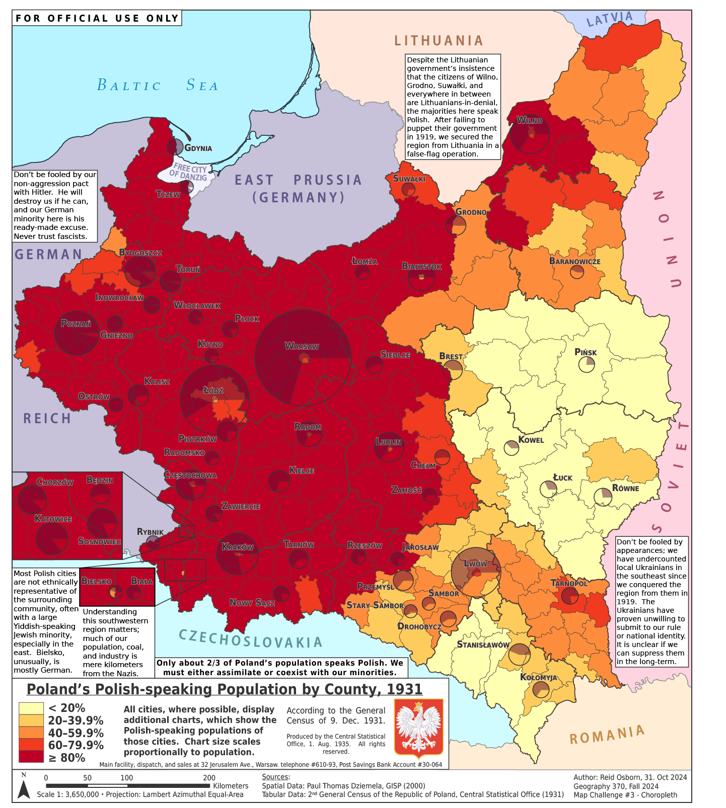
I have been captivated by the history of Interwar Poland (1918-1939) since 2016, and the subject more or less singlehandedly prompted my interest in cartography. This project, completed several months before my massive, multi-map poster on the same subject, is, despite arguably being something of a first draft, interesting in its own right. This map is meant to be something like a confidential government evaluation of the implications of the 1931 census results, showing how contemporary Polish government officials might view the extent of their multiculturalism. My idea was to make this be a brief that the Central Statistical Office might hand to a novice politician, to inform them of their country's demographic position, and how it related to international diplomacy. The contents of the map, the text, and how the data are presented, do not necessarily reflect my personal opinions. They are meant to be 'in-character'. If you want to go into more depth on the broader historical context, I recommend you read through my summary alongside the larger map.
Credits:
Created via ArcGIS Pro & Adobe Illustrator